May 3–6, 2026 | Gaylord Rockies, Aurora CO

No single satellite constellation covers every location at every moment. Revisit gaps, cloud cover, and sensor limitations mean critical windows go unmonitored. When you're operating across multiple theatres, that gap is a liability.
Meanwhile, imagery alone tells only part of the story. Without signals data, open-source intelligence, and entity tracking layered on top, analysts are working with an incomplete picture — making decisions slower, less confident, and more dangerous.
of intelligence gaps stem from single-source reliance
available for tasking from a single screen
built for interoperability
EMDYN fusion time from raw ingest to analyst-ready insight
GEOINT data fusion is the practice of combining satellite imagery with other intelligence layers — signals, tracking data, open sources, and your own proprietary feeds — to create a unified operational picture that no single data source can deliver alone.
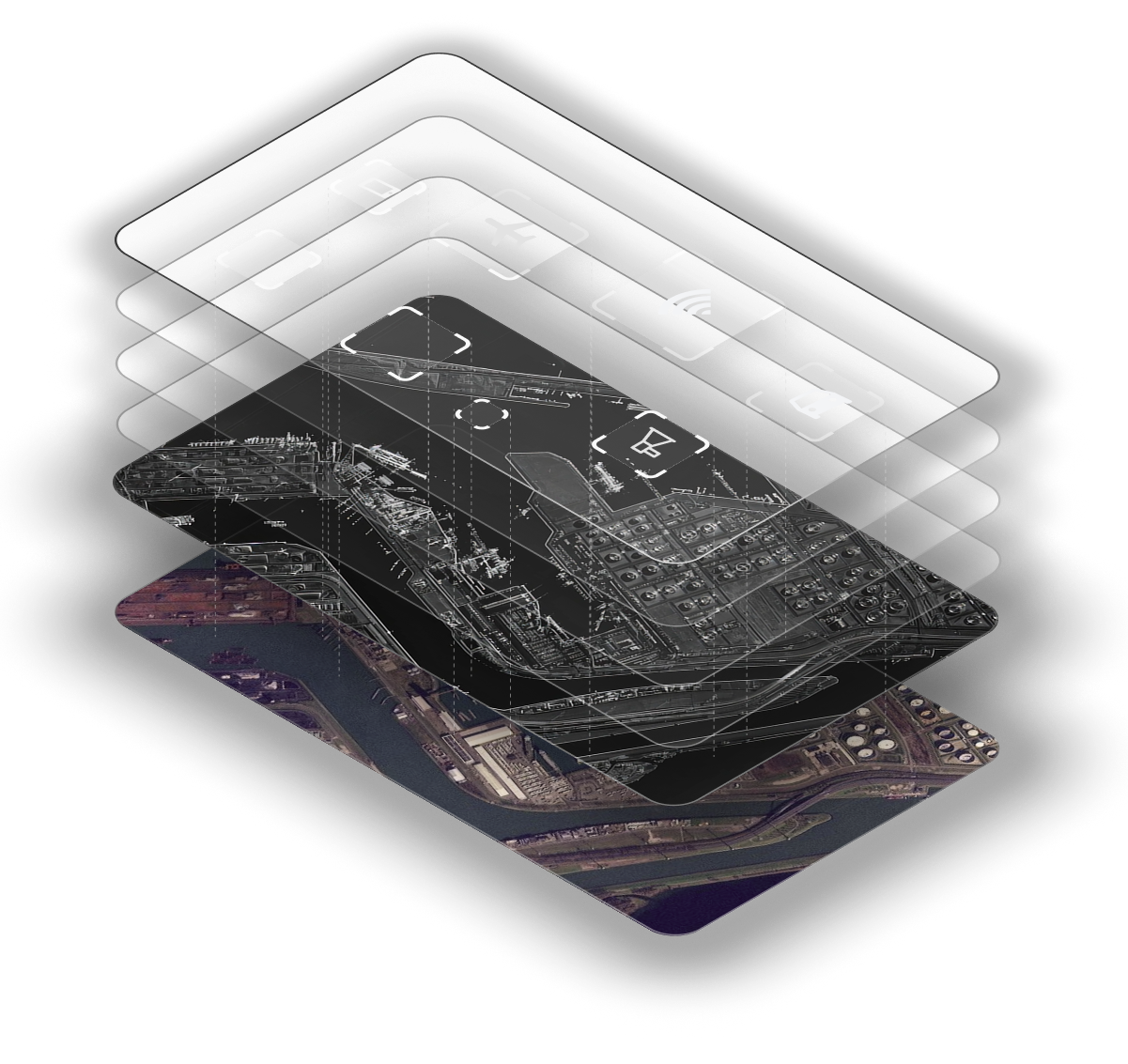
High-resolution optical and SAR imagery from multiple constellations forms the spatial foundation. You see terrain, structures, vehicles, vessels — the physical world, captured from orbit.

Vessel identity, heading, speed, port history overlaid on imagery
Real-time flight paths, aircraft type, altitude correlated spatially
Radio frequency intercepts geolocated onto the imagery baseline
Geotagged social posts, news events, public records time-stamped
Your own internal databases, case files, and sensor feeds
The EMDYN Platform was designed around how analysts actually work — eliminating friction, reducing cognitive load, and surfacing the insights that matter before you have to go looking for them.
From raw satellite ingest to analyst-ready fused product in under a second. No more waiting for separate processing chains — imagery, signals, and tracking data arrive pre-correlated.
Stop juggling 5+ separate portals. Every data layer — imagery, AIS, ADS-B, SIGINT, OSINT — lives in one unified workspace with shared timeline and spatial context.
Machine learning flags anomalies, detects change over time, and identifies patterns across data layers — so you focus on analysis, not pixel-hunting.
Track entities across intelligence disciplines. Link a vessel to an owner, to a signal, to a pattern — and build cases that persist across sessions and teams.
See a gap? Task an imagery provider directly from the platform — no switching to a separate tasking portal, no delay. See it, task it, get it.
Share fused intelligence products across teams in real time. Role-based access ensures the right people see the right data — classified and commercial side by side.
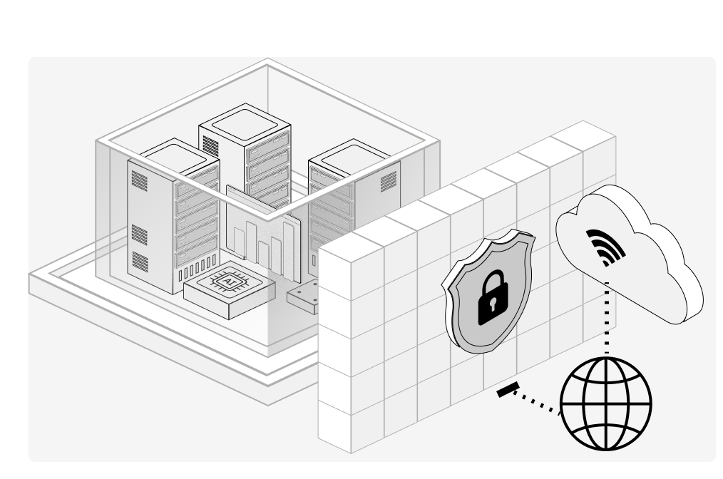
Mission-critical intelligence belongs on infrastructure you control. EMDYN deploys on-premise, in air-gapped environments, or in your government cloud — with the same full capability as our hosted platform.
Full on-premise deployment — the entire EMDYN Platform runs on your hardware, in your facility, behind your firewall.
Air-gapped compatible — no internet dependency required. Operates in SCIF and disconnected environments.
Data sovereignty guaranteed — your data never leaves your jurisdiction. No third-party cloud, no data residency questions.
GPU-optimised architecture — leverages on-prem GPU clusters for real-time analytics on trillions of data points.
Classified + commercial coexistence — role-based access control lets classified and unclassified data live on one platform.
We integrate all leading satellite imagery constellations so you get persistent, gap-free coverage of any location on Earth — regardless of weather, time of day, or revisit schedules.
Multi-constellation fusion means every coordinate is covered, regardless of individual revisit schedules.
Optical + SAR combined defeats cloud cover. When one sensor can't see, another can.
One platform, one analyst workflow. No switching between portals, no manual correlation.
Commercially available data feeds provide instant global coverage — hit the ground running on any emerging requirement.
Filter trillions of data points and visualise millions of outputs simultaneously. Big data becomes fast data.
Integrated record management maps links between people, organisations, hardware, and locations across all data layers.
Role-based access control and secure hosting means classified and commercial data coexist safely on one platform.
Task imagery directly from the platform. See a gap, fill it — no separate portal, no delay.
Classified feeds, proprietary databases, internal case files — securely integrated


